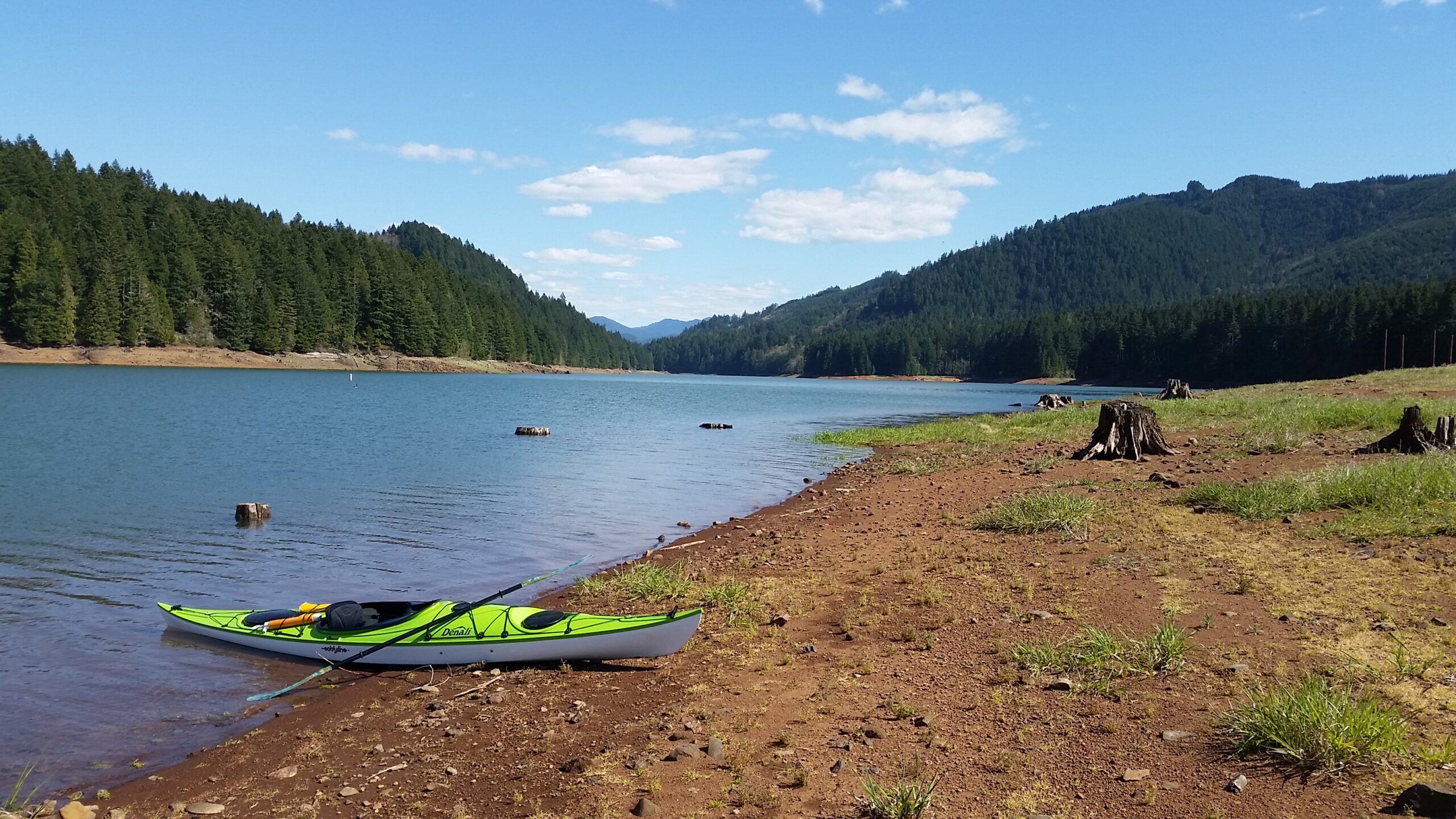
Last week I returned to one of my favorite places to paddle that is close to home, Fall Creek Lake. Located only two miles as the crow flies from where I paddled the last time, Fall Creek offers a different experience than Dexter Reservoir. It has places to explore and a larger body of water that can provide a variety of paddle distances.
The lake is really a reservoir at the confluence of two tributaries of the Willamette River watershed. The larger body of water behind the dam is approximately a mile in diameter with one arm that goes northeastward and another southeastward. The waters are clean and cold. On this paddle I assumed the water was cold, around 50 degrees and I wore a wet suit.
I’m a data geek and planning for a paddle on water bodies like Fall Creek Lake is one the things I enjoy the most about kayaking. I’ve also learned the information I can gather in advance can have a direct correlation to how much fun I have. I learned the hard way in the first couple years of paddling that not know details like wind speed and direction can be the difference between an enjoyable paddle to one that’s feels like you’re paddling to survive.
Depending on where I am planning to paddle, I start researching the following details:
- Water Access
- Weather Forecast including:
- Air Temperature
- Wind Direction and Speed
- Water Levels
- Water Temperature
- Visual Confirmation (webcams)
- Tides
For my paddle to Fall Creek Lake I already knew the water temperature in a nearby water body was in the low 50’s. Wearing what’s called a farmer john wet suit was a good idea. Knowing the other details was important, but for this blog I’ll focus on two: Water Levels and Water Access.
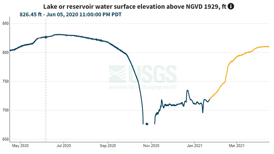
In places like Fall Creek Lake knowing water levels and access are especially important because any water behind a dam can fluctuate, sometimes significantly. For example, during this past year Fall Creek Lake’s high water line was 830 feet in June and then it plunged to 676 feet in November. I started watching water levels this spring to see how soon I could start paddling. I’ve had good access in different places when the water level is around 825 feet.
In conjunction with water levels, it is really important to know where you can get access at those levels. For bodies of water that don’t change a lot, access can be as simple as finding a shallow spot to launch from. I prefer more developed locations because they afford things like parking, ease of access, bathrooms, etc. These improved facilities are often managed by governmental jurisdictions which dictate operating hours and often fees.
In the case of Fall Creek Lake, the Oregon State Parks manage all of the improved and unimproved recreation sites to the lake. On this particular trip the only open access point was North Shore. Because North Shore was open and offers both a high-water and low-water ramp I assumed that there was water access. As it turned out the water level was 809 feet which meant I could drive out to the waterline (several hundred yards from where it normally is) and drop my boat off.
Knowing how to research details like water access and levels has turned out to be an important part of planning any trip. Not doing some homework in advance can result in a nice drive to a closed gate or water levels that require rappelling. Here are a couple of links I have found useful.
Resources
USGS National Water Dashboard: https://dashboard.waterdata.usgs.gov/app/nwd/?aoi=usgs-14150900
Oregon’s Recreation Site Status Map: https://www.arcgis.com/apps/opsdashboard/index.html#/36d86b9550f54ef2957626e48a66c364
Lane County Park: https://lcmaps.lanecounty.org/LaneCountyMaps/Parks/Index.html