I was looking for a little more adventure to a new paddling destination. My original plan was taking my kayak to Lake Tahoe and paddling into the famous Emerald Bay. I had spent my childhood summers living on the South Shore and grew memorized by a small campground in Emerald Bay accessible by boat. Tahoe did not work out so I needed to come up with a Plan B.
Looking for something more in-state (and to be noted just as far away) I decided to paddle Wallowa Lake in northeastern Oregon. I had camped there twice and the idea of paddling along snow capped mountains sounded appealing. As if driving to northeastern Oregon was not enough, I thought I’d scout out another new paddle destination, Lake Billy Chinook. Here’s a little travelogue of my adventure.
Tuesday, June 29 – 157 Miles Driven/0 Miles Paddled
5:37 pm: With my Eddyline kayak strapped on top and my Toyota Matrix jammed-packed with camping gear, I was ready to head off. Two of the boxes I had packed contained the majority of things I’d needed for camping, but there was no time to inventory the contents to make sure I had everything. It was time to go, and if necessary, I’d MacGyver it! I was off to find the campground on the Deschutes arm of Lake Billy Chinook. The original plan was to just do a drive-by on the way to the Wallowas. My wise wife, however, convinced me to camp an extra night so I could break up the driving and get an early paddling start.
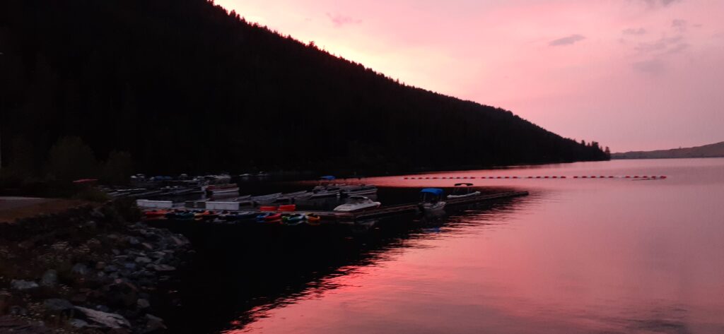
8:30ish pm: I arrived just after sunset with enough light to walk about the Deschutes campground to scout it out for next time. One of the things I learned is that a number of the campsites offer grassy areas. Even in this high desert campground they water and maintain grassy areas for those who want a nice tent site. Unfortunately, my campsite was not grassy and was strategically located downwind from the trash dumpster just on the other side of a fence next to my site. This was a park, sleep and dash stay, so c’est la vie.
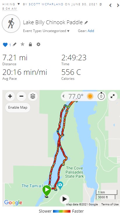
Wednesday, June 30 – 7.21 Miles Paddled/341 Miles Driven
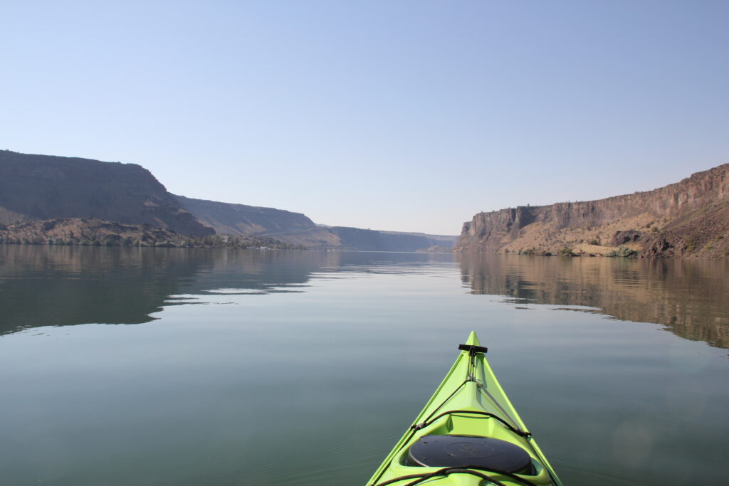
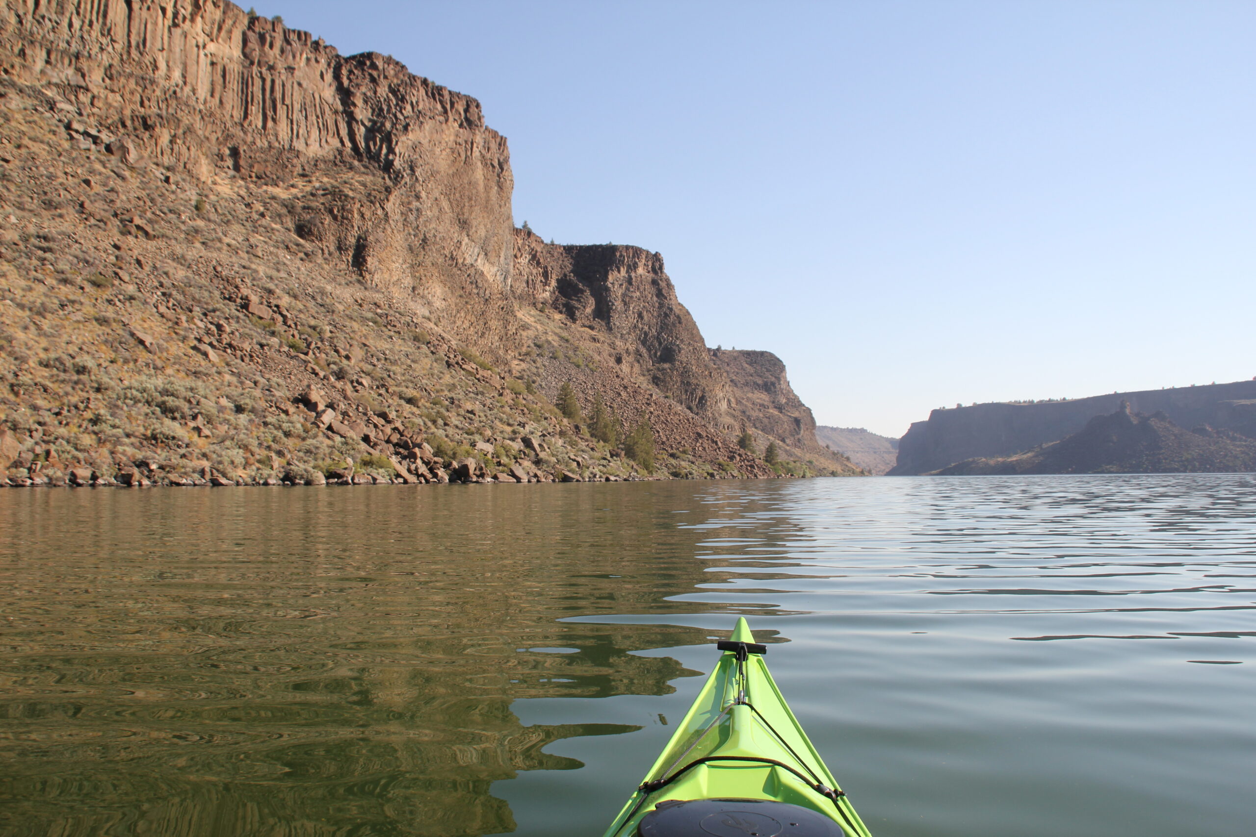
8:04 am – Fueled with a cup of coffee and a couple of pop tarts I was in the water before almost anyone. For the first 45 minutes, it was one of the quietest paddles I’ve ever taken. Little or no human sounds. I’ll let the photos tell the story but this is like taking a remote canyon hike but on water. Lake Billy Chinook is a body of water damned near the confluence of the Metolius River, the Deschutes River and the Crooked River. Each are deep canyons that gradually narrow as you go upstream. I put in at boat launch about a mile downstream from the bridge crossing the Deschutes River.
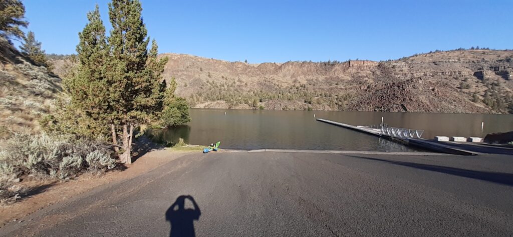
Launch into Lake Billy Chinook
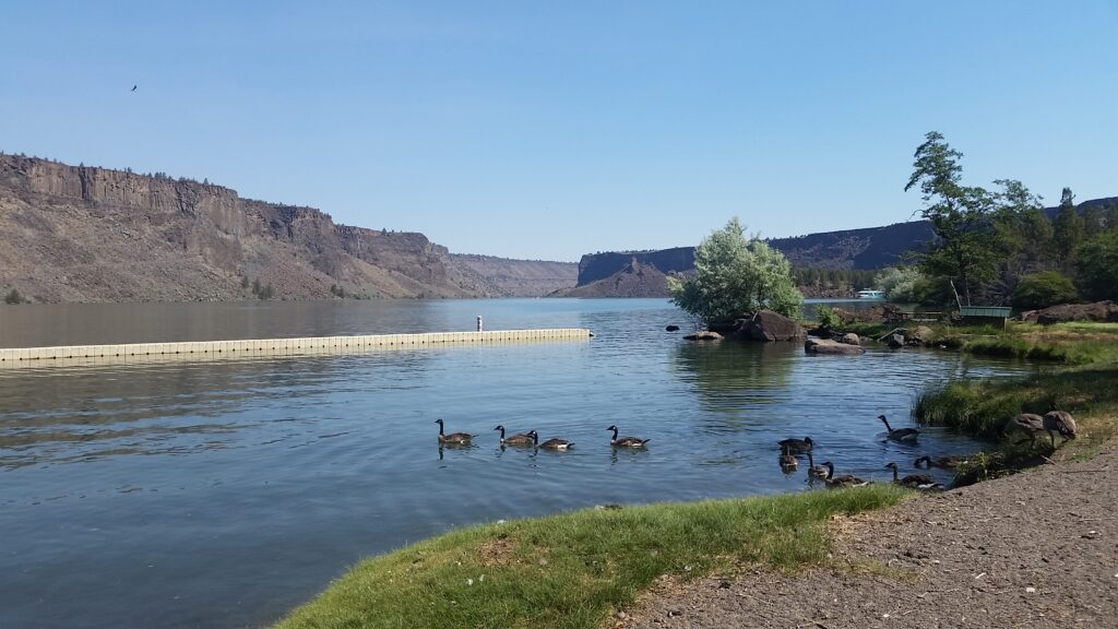
Except for a couple of houseboats moored at buoys I was the only one making ripples on the water. I would evidently see a boat or two fishing the area but I was pleasantly surprised to have the place to myself. Paddling solo anywhere has its risks and I expected on this body of water the biggest risk was being run over by a jet boat. This morning I had the place to myself with little or no wind and no sense of any current to help or resist my trip.
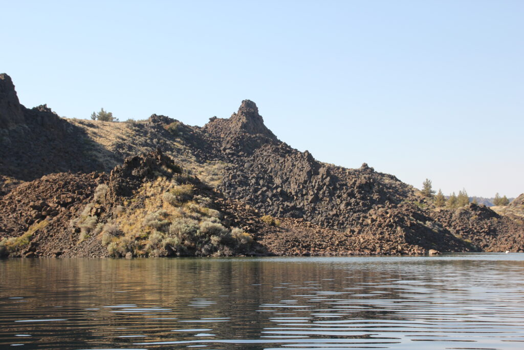
Volcanic Formations at Lake Billy Chinook
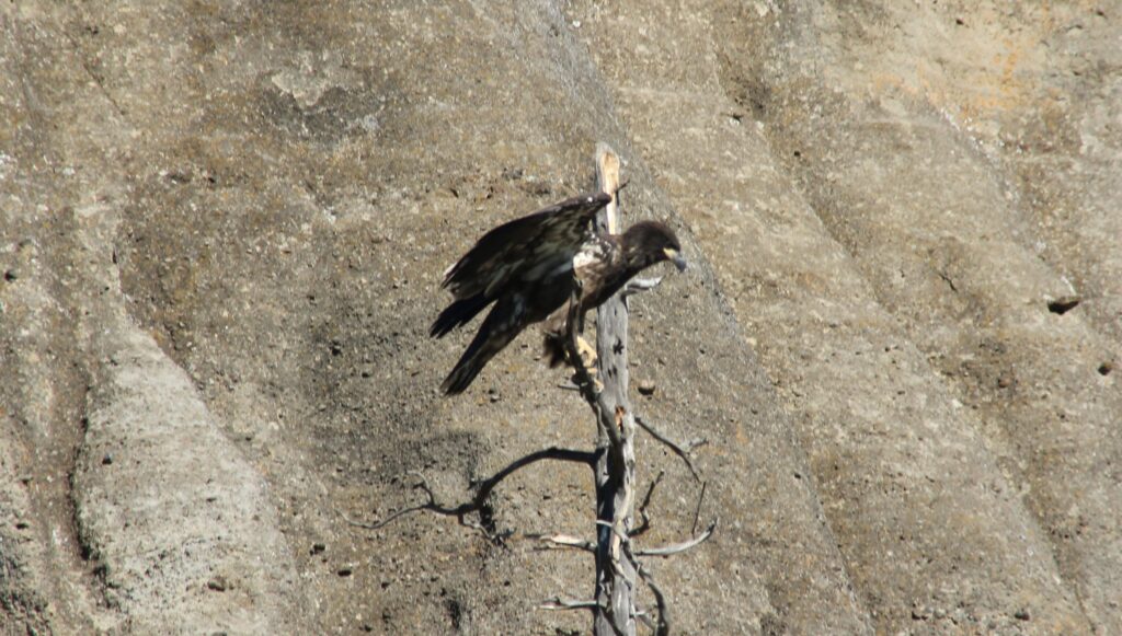
Golden Eagle at Lake Billy Chinook
Crooked River Arm of Lake Billy Chinook
Lake Billy Choonk Day Use Beach
After about an hour and a quarter of paddling I reached the point where the Deschutes River canyon merges with the Crooked River canyon. At this point I started seeing more powerful boats on the water, one of which creating some waves (see video).
The trip back was just as enjoyable with a stop at a beach in a day use area. My goal was to be off the water by or before noon to hit the road to the next destination, Wallowa Lake State Park.
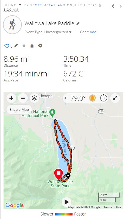
Thursday, July 1 – 8.96 Miles Paddled/Dozen Miles Driven
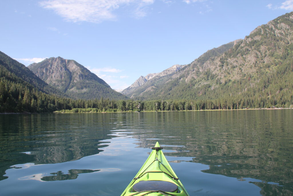
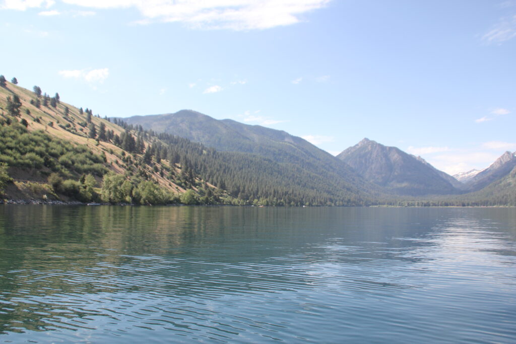
8:20 am – I got another morning start. The water was still, no wind and only a handful of boats fishing the lake. Wallowa Lake is a large lake formed between an snow capped mountain and a moraine. A moraine is created when a glacier carves out a mountain and carries with it sediment and rocks. When the glacier stops moving and recedes the sediment and rock deposited by the glacier leave a cupped area that usually fills in with water. This moraine is very large with a length of approximately four miles and at one point rises roughly 800 feet over the surface of the lake. To the west, the snow capped Chief Joseph Mountain towers 9,600 feet over the entire area.
South Shore of Wallowa Lake
Highest Point of Moraine on Wallowa Lake (left quarter of image)
I had underestimated the length of this paddle. At home, I had roughly measured out in Google maps a round trip around seven plus miles. Very doable. It turned into a nine mile paddle with an unexpected challenge. Much like hiking to the top of mountain with a lot of false peaks, the length of Wallowa Lake is very deceptive. It was really hard to judge progress in getting closer to my goal of landing on the north shore. Even with a GPS I keep expecting I was almost there and I was not. When I was roughly ¾ of mile away I was just about ready to turn around.
I really needed a stand up break and refill my water bottle. Because this valley was formed by a glacier, the lake is deep and does not offer a lot of easy pull out places unless it’s a dock. To give myself a chance for a break I told myself to paddle for another 10 minutes. It’s a mental technique I’ve used to reach a destination that seems out of reach. Sometimes it takes multiple times of telling myself to “go ten minutes more and see where I’m at” to beat the mental game. This time it only took once and after ten minutes I found myself almost to shore.
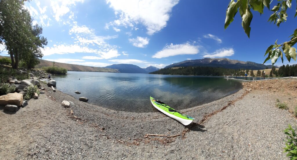
Panorama of Wallowa Lake
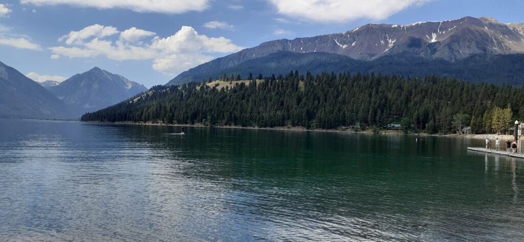
Wallowa Lake from North Shore
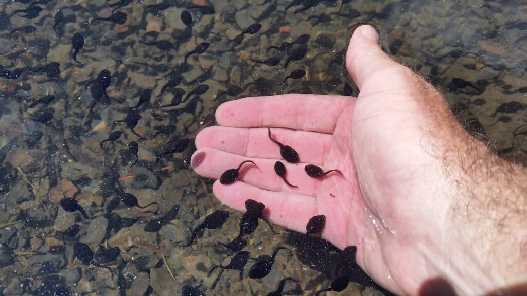
Tadpoles at Wallowa Lake
I would take my time returning to my launch point and pull out just after noon.
5:00ish pm – I’ll let the following video tell the story (turn up the volume), but roughly if you’re paddling at this lake, watch the forecast for thunderstorms (including pea size hail). Just before this footage was shot I watch two paddlers trying to get off the water before the mother of all thunderstorms hit. Watch the video to the end where you will see the only dry spot left under the shelter (i.e. where I was sitting). I would later find my tent, sleeping pad, clothes and sleeping bags in ankle-deep water.
Wallowa Lake After a Thunder Storm
Friday, July 2 – 463 Miles Driven/0 Miles Paddled
5:15 am – With a rough five hours of sleep in my car I decided to head home. I decided to return home the quickest way home through Portland with a little detour to my favorite coffee shop in Hood River and paddle store at Jantzen Beach.
Total Trip: 16.17 Miles Paddled/973 Miles Drive (Don’t calculate the ratio)